mvta logo

Meadow Vista Trails Assn

MVTA Area Trails

Trails on this page are listed in three sections: (See Context Map.)

If you have a favorite trail that is not listed, please send us an email.


Key:

Please see our Trail Use Guidelines regarding best practices.

Trails are Multi-Use (open to hikers, bikers and equestrians) unless otherwise noted...

Trail is designated as "No Horses" due to unsuitable footing or unsafe clearances in wooded sections.

Sorry, mechanized use not allowed. Trail is designated as "No Bikes," due to poor sight lines, creating a significant danger to other users, especially equestrians.

Sorry, motorized use not allowed. Trail is designated as "No Motorized," meaning no Off-Highway Vehicles, due to trail damage concerns or property owner's prohibition.

Wheelchair Trail Available Trail is wheelchair accessible.

Cougar habitatTrail traverses "Cougar Habitat."

Meadow Vista Area including Applegate, Weimar and Colfax

Driving time to each trailhead from Meadow Vista, center of town, is shown in (parens.)

Trailhead Route Length Features Notes
Combie Road,
corner of Placer Hills Rd.
(1 min.)
Directions
 MV Arena Trail:
Roadside trail follows Combie Road and Hillsdale Road to MV Riding Arena,
Trail Route Map
2.5 mi.
one-way distance
Single track, easy grades Be cautious of road traffic.

Key to arena parking area available from MVTA Arena Admin for $5.
Sugar Pine Rd.,
PG&E canal access at corner of Placer Hills Rd. and Sugar Pine Rd.
(2 min.)
Directions
Sugarpine Trail:
follows Winchester Estates perimeter
map
6.4 mi.
loop distance
Woodland views; single track, flat to moderate grades, except where trail climbs over Sugarpine Mtn. (about 500ft) Generally good footing; passes close to private homes in some places, stay on trail and be considerate.
Sorry, motorized use not allowed.Cougar habitat
Weimar Institute,
I-80 at West Paoli Exit
(20 min.)
Directions
 Weimar Institute Trails:
private trail network
map
1 to 5 mi.
loop distance
300 acres of trails in pine, oak and manzanita groves Many trails are wide and groomed; others are single-track. Some are designated No-horses.
Sorry, no mechanized use.Sorry, motorized use not allowed.Cougar habitat
Cerro Vista Rd.,
Applegate
(20 min.)
Directions
Cerro Vista Ridgeline Trail
map
2 mi.
distance out and back
Canyon views; oak and manzanita groves. Mostly single track and old wagon trails; minor grades; route uses some paved road sections.
Cougar habitat
"Assassin's Trail"
Boole Rd. to junction with Heather Glen trail
map
5 mi.
distance one-way
Canyon views; single track and old wagon trails. Mostly flat, but with a long, steep grade midway.
Sorry, motorized use not allowed.Cougar habitat
 Upper Clementine trail:
to Am. River and back
map
5 mi.
distance out and back
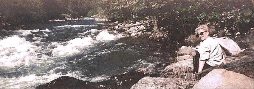
Canyon views; riverside rest stop; wading/swimming. Some moderate climbs/descents; optional ford of river in summertime
Cougar habitat
Boole Training Hill:
route between Upper Clementine trail (near Long Point) and Cerro Vista Ridgeline Trail
map
4 mi.
loop distance
Canyon views; serious hill climb. Steep climb with several good spots to pause and enjoy views; downhill direction not recommended for horses unless leading.
Sorry, motorized use not allowed. Cougar habitat
Esoteric Trails, Applegate
(20 min.)

Note: Trails on the Esoteric Society's land should not be used without an ID Badge, avaliable to MVTA Members on request. Contact our Trails Coordinator for more info.

Private Trail Network on grounds of old Esoteric Publishing Society.
map
4 mi.
loop distance
Canyon views; pine forest and manzanita groves; historic buildings from late 1800's. Gated access to eastern end of Assassin's Trail. Graded roads, old wagon roads and single track. Access allowed for MVTA members with gate key; not open to general public.
Sorry, motorized use not allowed. Cougar habitat
"Assassin's Trail" west to Boole Road trailhead
map
5 mi.
distance one-way
Accessible from back gate of Esoteric grounds.

Canyon views; single track and old wagon trails.
Some steep climbs/descents
Sorry, motorized use not allowed. Cougar habitat
Heather Glen Trail to lower Codfish Creek and North Fork of American River
map
5 mi.
distance one-way
Accessible from back gate of Esoteric grounds.

Mostly wagon roads, some single track. Oak, Sugar Pine and Ponderosa forest; very secluded. Views into Codfish Creek canyon and Vore Mine area. Side trail at bottom to Codfish Falls. Wading and swimming in Am. River.
Last 1/4 mile down to Creek is very steep. Ponderosa Bridge can be reached from Codfish Creek via a narrow foot trail (not recommended for horses.)
Sorry, motorized use not allowed. Cougar habitat
Grubb Mine Trail to upper Codfish Creek crossing and Vore Mine Trail
map
[Trail map not yet avaliable]
5 mi.
distance one-way
Accessible from back gate of Esoteric grounds.

Partly wagon road, mostly single track. Oak, Sugar Pine and Ponderosa forest. Views into Codfish Creek canyon.
Last few hundred feet of trail down to creek is narrow and footing is sometimes poor. Footing when crossing creek is also tricky.
Sorry, motorized use not allowed. Cougar habitat
Bear River Campground,
Colfax
(20 min.)
Directions
Bear River Camp Trails,
map

loop distance
Variety of trails near the Bear River
Sorry, motorized use not allowed.Cougar habitat
Bunch Canyon,
Yankee Jim's Rd. off Ponderosa Way, Colfax
(20 min.)
Directions

Note: Equestrians may want to stage from the wide turnout part way down Yankee Jim Rd. The entire road is driveable, but becomes a rough graded road farther down.

Yankee Jim's Road to Shirttail Canyon Bridge and back
map
7 mi.
distance out and back
High suspension bridge over American River's North Fork at confluence with Shirttail Creek, a Mecca for bungee jumpers and kayakers. Dirt road continues to Foresthill (add another 15.5 mi. to your round trip) and passes Bridalveil Falls, a spectacular creek waterfall 1/2 mile from the river. Graded dirt road; easy going. Watch for vehicle traffic (infrequent on weekdays.)
Cougar habitat

Ponderosa Bar,
Weimar
(20 min.)
Directions

Note: Ponderosa Bar was a real saloon, not a gravel bar along the river. Their parking lot remains available, but please don't leave a mess behind. Riders should thoroughly spread any manure or take it with them.

Sorefinger Point trail to North Fork, Am River
map
6.5 mi.
distance out and back
Canyon views; graded private road (Do not drive down; there is no parking allowed.) long moderate grade on dirt road.
Cougar habitat
6+ mi.
loop distance
Proceed about 1/4 mile past Sorefinger Road turnoff; look for green gate on left. Hilltop area adjacent to Ponderosa BLM road has numerous Mt Bike trails Single track dirt trails, some very steep downhill runs
Sorry, motorized use not allowed. Cougar habitat
BLM access road to Ponderosa Bridge,
map
3.25 mi.
distance one-way
Canyon views; suspension bridge over Am. River, popular swimming hole with sandy beach, parking is limited. Good footing; long moderate grades on drivable dirt road; very exposed in hot weather (Carry plenty of water.)
Cougar habitat
Trail to Codfish Falls
map
3 mi.
distance out and back
River and creek-side views. Codfish Falls is beautiful in springtime, but can dry up in the summer. Single track trail follows west side of Am. River downstream and then Codfish creek upstream to falls.
Sorry, no mechanized use.Sorry, motorized use not allowed. Cougar habitat
BLM access road to Foresthill Road:
BLM access road continues to Foresthill Road
map
3.3 mi.
distance one-way
Canyon views; cross suspension bridge over Am. River and continue uphill. Good footing; long moderate grades on drivable dirt road; very exposed in hot weather (Carry plenty of water.)
Cougar habitat
Stevens Trail,
Colfax
(20 min.)
Directions
 Stevens Trail to Am. River and back
map
7 mi.
distance out and back
Spectacular canyon views; rugged waterfalls; wildflowers profuse in Springtime moderate grades; very narrow cliffside passage in one place. Note: Stevens Trail is not recommended for horses beyond where it passes the old mine entrance.
Sorry, motorized use not allowed. Cougar habitat
Trailhead Route Length Features Notes
 

Auburn Area including Foresthill and the Western States Trail

Driving time to each trailhead from Auburn, I-80 at Hwy 49 exit, is shown in (parens.)

Trailhead Route Length Features Notes
Hidden Falls Regional Park,
Auburn
(30 min.)
Directions
Hidden Falls Park trail network
map
6+ mi.
loop distance
Open to riders, walkers and mountain bikers, the park (formerly the Spears and Didion ranches) was first opened to the public in October, 2006. Easy to moderate grades on well-conditioned, single and wide-track trails.
Wheelchair Trail AvailableSorry, motorized use not allowed. Cougar habitat
Cool Trailhead Parking
(30 min.)
Directions
Olmstead Loop Trail (aka, Knickerbocker Trail)
map PDF
10 mi.
loop distance
Spectacular views of Sierra Range; Canyon views. State Park location: parking fee applies. Rolling hills, with some moderate grades. Note: there are plank bridges over some creeks, but they are NOT built for horses
Sorry, motorized use not allowed. Cougar habitat
Ro-B loop Trail
Wendel Robie Loop begins/ends at the Hwy 49 limestone quarry entrance.
map
[Trail map not yet avaliable]
15 mi.
loop distance
Beautiful ride through lush wooded ravines and natural meadows; Canyon views; adjoins the Auburn Lake Trails trail network. Mostly single-track; moderate to steep grades; crosses Hwy 49 (traffic is heavy at times)
no bikesSorry, motorized use not allowed. Cougar habitat
Drivers Flat,
Foresthill Road, roadside parking
(30 min.)
Directions
Foresthill Divide Loop Trail
map PDF
10 mi.
loop distance
Beautiful ride through lush wooded areas; Canyon views.
Caution Equestrians: heavily used by large groups of bikers.
Multi-use, mostly single-track; moderate grades; crosses Foresthill Divide Rd twice (traffic heavy at times)
Sorry, motorized use not allowed. Cougar habitat
Drivers Flat,
Foresthill Road, off-road parking
(30 min.)
Directions
BLM road to American River and Western States Trail at Rucky Chuck
map
4 mi.
distance out and back
Canyon views Steep, but wide graded road down to campground by the river.
Cougar habitat
Foresthill Center
at Yankee Jim's Road
(25 min.)
Directions
Yankee Jim's Road to Shirttail Canyon Bridge and back
map
15.5 mi.
distance out and back
Beautiful ride through lush wooded areas, Canyon views, Bridalveil Falls (1/2 mile before the bridge.) Steep, but wide graded road down to suspension bridge over North Fork of American River.
Cougar habitat
Western States Trail
Lake Tahoe to Auburn

Tevis Trailhead Directions

WS Run Trailhead Directions


Tevis Ride Trail
100 mi.
distance one-way
Forest trails which cross the Sierra Nevada summit above Squaw Valley. Passes through wilderness areas and BLM lands, finishing at Auburn. These two annual endurance events use the same 100-mile trail with only minor course differences. Combination of single track, wagon roads and logging roads.
no bikesSorry, motorized use not allowed. Cougar habitat

WS Run Trail
Auburn Staging Area
(5 min.)
Directions
Am. River Trail, climb out via "Cardiac Hill"
map
[Trail map not yet avaliable]
6 mi.
loop distance
Auburn Dam site; Canyon views. long, steep climbout with switchbacksno bikesSorry, motorized use not allowed. Cougar habitat
Western States Trail to Cool
map
[Trail map not yet avaliable]
7 mi.
distance one-way
Crosses American River via No Hands Bridge, continues to town of Cool some steep climbs/descents
no bikesSorry, motorized use not allowed. Cougar habitat
Am. River Trail to Rattlesnake Bar
map
[Trail map not yet avaliable]
10 mi.
distance one-way
Views of old Auburn Dam site; Canyon views; views of Lake Folsom. moderate grades; single-track, rocky in places
Sorry, motorized use not allowed. Cougar habitat
Rattlesnake Bar,
Loomis
(20 min.)
Directions
Am. River Trail to Sterling Point
map
[Trail map not yet avaliable]
5 mi.
distance one-way
Wooded shoreline, views of Lake Folsom. State Park location: parking fee applies. Single-track, good footing, but rocky in places
Sorry, motorized use not allowed. Cougar habitat
Sterling Point,
Granite Bay
(30 min.)
Directions
Am. River Trail to Beals Point
map
[Trail map not yet avaliable]
3 mi.
distance one-way
Wooded shoreline, views of Lake Folsom. Not a State Park location: No fee. Single-track, good footing, but rocky in places
Sorry, motorized use not allowed. Cougar habitat
Beals Point
(40 min.)
Directions
Am. River Trail to Negro Bar
map
[Trail map not yet avaliable]
10 mi.
distance one-way
Wooded shoreline, views of Lake Folsom. State Park location: parking fee applies. Single-track, good footing, but rocky in places
Sorry, motorized use not allowed. Cougar habitat
Negro Bar
(45 min.)
Directions
Am. River Trail north to Auburn Staging Area
map
[Trail map not yet avaliable]
30 mi.
distance one-way
Wooded shoreline, views of Lake Folsom. State Park location: parking fee applies. Single-track, good footing, but rocky in places
Sorry, motorized use not allowed. Cougar habitat
Trailhead Route Length Features Notes
 

High Country Areas including the Pacific Crest Trail

Driving time to each trailhead from Auburn, I-80 at Hwy 49 exit, is shown in (parens.)

Trailhead Route Length Features Notes
Diggins Hill Road
Dutch Flat
(30 min.)
Directions
Dutch Flat to Mule Springs
Park at edge of town of Dutch Flat; cross dam at Dutch Flat Reservoir (Yuba River) to Mule Springs
map
10 mi.
distance out and back
Historic Mule Springs site (Camp used during Donner Party rescue efforts) wide, graded roads
Cougar habitat
Euchre Bar,
Alta
(45 min.)
Directions
Old mining trail to Am. River and then to Humbug Creek and back (trail also continues to Foresthill Divide at Baker Ranch, an additional 5 mi. round trip)
map
[Trail map not yet avaliable]
15 mi.
distance out and back
Spectacular vistas of North Fork river gorge; suspension bridge at river crossing; scattered remains of original gold mining equipment; Old Dorer Mine (abandoned) Long, steep canyon decent with many switchbacks; trail narrow in places with steep, 200-ft. dropoffs to river
Sorry, motorized use not allowed. Cougar habitat
Pacific Crest Trailhead, I-80 South Side
(55 min.)
Directions
Pacific Crest Trail, I-80 to Hwy 40
PCT route leading South to Hwy 40 near Sugar Bowl ski area. PCT continues South toward the Granite Chief Wilderness.
map
7 mi
distance out and back
Gorgeous mountain vistas and alpine meadows. Moderate to difficult grades on mostly single track trails. Some trail sections are very rocky. Little or no water on trail in some areas The PCT crosses under I-80 via a tunnel, just east of the Donner Summit highway rest areas.
Sorry, bikes not allowed Sorry, motorized use not allowed. Cougar habitat
Pacific Crest Trailhead, I-80 North Side
(55 min.)
Directions
Pacific Crest Trail, I-80 to Paradise Lake
PCT route leading North passes beneath Castle Peak and Peter Grubb Hut. Side trail goes to Paradise Lake. PCT continues toward Sierra City.
map
14 mi.
distance out and back
Looney Meadows
off Hwy 20
(90 min.)
Directions
Interpretive Trail around Looney Meadows and other area trails
map
[Trail map not yet avaliable]
5 mi.
loop distance
Beautiful alpine lakes and streams; excellent camping spots. Looney Meadows loop is fairly flat, but other trails have long climbs and decents.
Cougar habitat
Eagle Lakes Exit,
off I-80
(45 min.)
Directions
Eagle Lakes Trailhead to Fordyce Creek
map
[Trail map not yet avaliable]
20 mi.
distance out and back
Beautiful alpine lakes and streams; spectacular views of Sierras some steep climbs, some smooth granite areas
Cougar habitat
Skillman Campground,
off Hwy 49, above Nevada City
(45 min.)
Directions
Multiple routes within a network of trails
map
[Trail map not yet avaliable]
Many possible loops
loop distance
Skillman Reservoir area; pine and oak forests good footing; single track and graded logging roads; some steep climbs; creek crossings.
Cougar habitat
Lasier Meadows Horse Camp,
off Hwy 89, N of I-80
(120 min.)
Directions
Pacific Crest Trail Access
map
[Trail map not yet avaliable]
any distance, North or South
distance out and back
Wide, unobstructed Sierra range vistas; wooded canyons; horse camp with four paddocks at trailhead. some steep climbs, rocky in places; little or no water on trail in some areas
Sorry, bikes not allowed Sorry, motorized use not allowed. Cougar habitat
Trailhead Route Length Features Notes

MVTA tries to assure the accuracy of the trails information presented,
but can make no claims to such. Please let us know if any entries are incorrect.

Email your comments or questions to our Trails Coordinator.